Google Earth for Mapping and Visualization
🌍 Google Earth – FAQ (English & Myanmar)
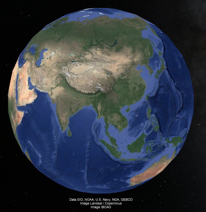
Q1. What is Google Earth?
Google Earth is a digital mapping and visualization tool that allows users to explore satellite imagery, maps, terrain, and 3D buildings across the globe.
Q1. Google Earth ဆိုတာဘာလဲ?
Google Earth က ကမ္ဘာပေါ်ရှိ ဧရိယာအားလုံးကို satellite imagery, မြေပုံ, မြေမျက်နှာပြင်နဲ့ 3D အဆောက်အဦးတွေကို ကြည့်ရှုနိုင်တဲ့ digital mapping နဲ့ visualization tool တစ်ခု ဖြစ်ပါတယ်။
Q2. What are the main features of Google Earth?
Satellite imagery, 3D terrain and buildings, street view, historical imagery, measurement tools, and placemarking.
Q2. Google Earth ရဲ့ အဓိက feature တွေကဘာလဲ?
Satellite imagery, 3D မြေမျက်နှာပြင်နဲ့ အဆောက်အဦးများ, street view, historical imagery, တိုင်းတာမှု tools တွေ နဲ့ placemarking တို့ ပါဝင်ပါတယ်။
Q3. How can Google Earth be used in surveying and mapping?
To measure distances and areas, visualize terrain, plan routes, and monitor land-use changes.
Q3. Surveying နဲ့ mapping မှာ Google Earth ကို ဘယ်လိုအသုံးပြုနိုင်လဲ?
အကွာအဝေးနဲ့ ဧရိယာကို တိုင်းတာရန်, မြေမျက်နှာပြင်ကို ကြည့်ရှုရန်, လမ်းကြောင်းများကို စီမံရန်, မြေ အသုံးပြုမှု ပြောင်းလဲမှုတွေကို စောင့်ကြည့်ရန် အသုံးပြုနိုင်ပါတယ်။
Q4. Can Google Earth provide real-time data?
Mostly no; it provides mostly up-to-date satellite images, but not live real-time tracking.
Q4. Google Earth က real-time data ပေးနိုင်မလား?
မဟုတ်ပါဘူး။ Google Earth က အများအားဖြင့် နောက်ဆုံးရရှိထားတဲ့ satellite imagery တွေကိုပဲ ပြသပေးပြီး real-time (အချိန်နှင့်တပြေးညီ) tracking ကို မပေးနိုင်ပါ။
Q5. What file formats can be imported into Google Earth?
KML, KMZ, GPX, and CSV for placemarks, routes, and spatial data.
Q5. Google Earth ထဲကို ဘယ် file format တွေထည့်သွင်းနိုင်လဲ?
Placemark, routes နဲ့ spatial data များအတွက် KML, KMZ, GPX နဲ့ CSV file format တွေ ထည့်သွင်းနိုင်ပါတယ်။
Q6. What is a placemark in Google Earth?
A marker or pin used to highlight a specific location on the map.
Q6. Google Earth မှာ placemark ဆိုတာဘာလဲ?
Map ပေါ်က တိကျတဲ့ နေရာတစ်ခုကို အမှတ်အသားပြထားဖို့ သုံးတဲ့ marker သို့မဟုတ် pin ဖြစ်ပါတယ်။
Q7. What are common applications of Google Earth?
Education, environmental monitoring, urban planning, disaster management, and navigation.
Q7. Google Earth ကို အများဆုံး ဘာတွေမှာ အသုံးပြုလဲ?
ပညာရေး, ပတ်ဝန်းကျင်စောင့်ကြည့်ခြင်း, မြို့ပြစီမံရေး, ဘေးအန္တရာယ် စီမံခန့်ခွဲမှု, လမ်းညွှန်/navigation စတဲ့ အရာတွေမှာ အများဆုံး အသုံးပြုပါတယ်။